I recently had the pleasure of visiting north central and northwestern Ohio including Seneca, Hancock, and Lucas Counties. I was pleased to find that residents were willing to share stories of the region's commercial history and am taking advantage of their hospitality by summarizing some of what I learned. I had only three days to explore and, as such, merely scratched the surface of what could have been uncovered if I had put forth a more vigorous effort. I began my tour in Seneca County, which was founded in 1820 from Huron County. Tiffin, the county seat, was founded by Josiah Hedges in the year 1821. It's said that Governor Edward Tiffin of Chillicothe was a friend of Josiah Hedges, who named the town after his friend.
I started by exploring the Sanborn Fire Insurance map from Tiffin to see what was going on in the area during the late 19th century. The area along the Sandusky River on River Street (now Riverside Drive) was developed with G.W. Keller Flour Mills/Pearl Mills, Brickner & Ehrenfried Distillery and Schumann's Brewery. The flour mill, reportedly built by Josiah Hedges in 1822, is now known as the
Pioneer Mill restaurant. This mill company was the first major industry in Tiffin. It began grinding in 1824 and was operated by Josiah Hedges' son-in-law operated until 1848 when it was transferred to William Hunter. Hunter sold the mill to Gottfied Diemer in 1864, and in 1866 it was purchased by Ruben Keller. Fire destroyed the original frame structure 1874 and Keller rebuilt it.
 |
| 1887 Sanborn Fire Insurance map of Tiffin, OH |
Other former owners include George and Edward Cunningham, Joel Keller, George Keller, Henry and Sheldon Houser, Ervin Graves, and Frank W. Bacon who purchased the mill in 1902. Another fire damaged the mill in the 1930s. The mill reportedly ceased operations around 1950.
 |
| The Tiffin Tribune, Sep 3, 1869 |
|
 |
| The Tiffin Tribune, Aug 15, 1872 |
|
 |
| Hedges-Hunter-Keller-Bacon Gristmill in 2019 (110 years later) |
 |
| The Sandusky Register April 28, 1937 |
Further south at 215 Riverside Drive was the Brickner and Ehrenfried whiskey distillery (constructed at the site of the former Wagner-Brickner No. 51 distillery). This is Tiffin's only known distillery and is still standing! The present structure was estimated to have been built between 1873 and 1881 by Cyrus Bowman and is also known as Bowman's Distllery.
 |
| The Tiffin Tribune, Oct 17, 1872 |
In the 1887 Sanborn map, it is listed as the Brickner & Ehrenfried distillery. John Baptiste Ehrenfried (1845-1922), and Andrew J. Brickner were born in Bavaria, Germany, and both had
several business enterprises within the Tiffin community. The distillery operated until around 1890 and subsequently became The Pure Soap & Toilet Co. by 1908 and Tiffin Robe and Tanning Co. by (1920-1934). Ownership of the leather operation was taken over by A.J. and J.O. Pilar (1936-1942). Riverside Furniture Company operated in this building from around 1956 to 1971.
Next door to the distillery was the former Clinton/Mueller/Phillip Gummel Brewery/Schumann & Company Bavarian Brewery/Tiffin Brewing Company. The building has a fascinating history which was passed on to us by the owner who graciously gave us an impromptu tour.
 |
| 1874 |

The building represents the German heritage of Tiffin. Mueller and Schmidt established a lager brewery in Tiffin in 1848, which is said to be the first lager beer brewery in Ohio. In 1854, they constructed the structure on River Road and moved their enterprise to this location. In 1885, Philip Grummel bought the operation and brewer's house next door, known as the Christ Mueller house. The business was known as the Tiffin Brewing Company from 1889 to 1915. The Grummels never resumed the operation after prohibition ended, and the structure was used for the Grummel Bros. Ice and Beverage Company. In 1925, Tiffin Scenic Studios Inc. moved into a part of the building. They still occupy this location today! The firm makes stage scenery and rigging for a national market.
 |
| Christ Mueller House - Mueller lived here until 1885 when much of his land, including this house, was transferred to Philip Grummel at a sheriff's sale |
A cooper's pond was formerly located immediately north of the present building. The brewery made its own barrels for beer and used the pond to soak barrel staves. The pond disappeared by 1925. Just north of the pond was a brick structure used as a stable.
 |
| Former brewery stable |
One "fun fact" about this brewery is that it contains underground tunnels (now walled shut at the river bank and brewery entrance) that used to run from the brewery across the road to a malt house. The tunnel was used to transport beer across the road to the river to avoid the tax for transporting it over the road. Horses and wagons were used to get supplies to and from the river, and the old wagon entrance on the rear of the building (now walled shut) is still visible. During the World Wars, the tunnel was used to grow mushrooms, which were harvested for commercial purposes. The opening on the riverbank may still be visible, although the river now extends all of the way to River Road.
 |
| Brewery Layout in 1887 - Notice the malt house across the river |
 |
| Underground tunnels! |
After touring the brewery, we were pointed in the direction of another commercial structure with an intriguing history - the Kildow building on East Perry Street. The three-story building on East Perry Street was built to house the W.H. Kildow Cigar Company, established in 1892. The Kildows operated the cigar business for 40 years. William Kildow passed away in 1936 and his sons continued the business. In 1944, manufacturing was discontinued but son Thomas Monroe Kildow maintained a wholesale cigar and candy business at this location. It is presently the Antique Warehouse.
 |
| W.H. Kildow building on East Perry Street in Tiffin, Ohio |
 |
20 Jan 1944 - The Evening Independent
(Massillon, Ohio) | |
|
|
Much of the building is unaltered and we were informed that the original colors were used when repainting the tin ceiling on the first floor.
There were other interesting bits of history still intact, including the original employee bathrooms and original wooden stair steps worn in the middle from continuous use.
Next on the list was the former Ohio Lantern Works (formerly the Tiffin Tool Company building) and Hotel Berlin buildings shown here on the 1896 Sanborn map. The Tiffin Tool Company manufactured farm and garden implements but was only in business for a few years until 1889. The building was constructed between 1883 and 1885.
 |
| 1896 Sanborn Map |
The Ohio Lantern Co. was reorganized from the Buckeye Lantern Company in Bellaire, Ohio (est 1838) by Alfred L. Baron and B.F. Cockayne during the natural gas boom in northwestern Ohio. The company was first relocated to Findlay, Ohio and then moved again to Tiffin in 1889. The factory was strategically located on the railway line. A. Baron died in 1904 and his son, Charles, managed the plant. They plant produced tubular lanterns, desk lanterns, wire-cushioned oil cans, and other metal stamping products. "Baron Lanterns" were sold around the world and noted for their reliability. The company ceased operations in 1949 and Ohio Power Company operated its service department here. It was then used for storage from 1956 to 1968, and Standard Roofing and Sheet Metal Supply occupied the structure in the 1970s. It is currently occupied by Sealed & Striped of Tiffin, a line marking service.
Some examples of early lanterns manufactured here can be found online:
 |
| Belmont Chronicle (Saint Clairsville, Ohio) · 31 Oct 1878 |
|
 |
| Specifications and Drawings of Patents Issued from the U.S. Patent Office January 1, 1872 |
|
The Hotel Berlin building is a bit more obscure. It is depicted on the 1896 and 1901 Sanborn maps on the corner of Lafayette and Hudson Streets. It is shown as an apartment building in 1908 and later. It would probably take access to historical documents, which I do not have available to me, to dig up more information on the former hotel as it was short-lived. But, a lovely building nevertheless.
There are many more historical buildings to view in this city, and many are listed on the
National Register of Historic Places for Seneca County. I ended the day at the Seneca County Historical Museum, which is in the former home of local businessman, Rezin W. Shawhan. The house was built in 1853 and donated to the county in 1941.
The museum has excellent exhibits including Tiffin and Beatty Glass, early furniture handcrafted by Seneca County pioneers, linens and artifacts, and a educational display on the Junior Order United American Mechanics National Orphans Home which we decided to visit afterwards. The museum is highly recommended.
 |
| Beatty Glass exhibit at the Seneca County Museum |
The Junior Order Home orphanage was established in 1896 and closed in 1944. It began as a single farm residence with three children and grew into a self-supporting community with about 1,200 residents in its peak years (1930-1937). The 200-acre campus had residence cottages, a chapel, gymnasium, grade and high schools, vocational school, hospital, dining hall, bank, post office, nursery, library, laundry, cannery, power plant and administrative building. The superintendent was Charles Kernan. A former orphan himself, Mr. Kernan moved to Tiffin in 1901 and built the operations at the orphanage around the hope of a normal family life. No children at the orphanage were sent out for adoption and all children had the opportunity for an education.
 |
| Residence cottages at the Junior Order Home |
According to an article in The Dayton Herald (22 Aug 1944), the State of Ohio acquired the orphanage in 1944.
The following day, I decided to explore an area of northwestern Ohio formerly known as "
The Great Black Swamp." The densely forested swamp, which once covered the region from Sandusky to Findlay, and west to Fort Wayne, Indiana (approximately a million acres), was a wetland formed by the retreating glaciers. In the 1850s there was an organized attempt to drain the swamp for agricultural use and travel. Not much remains of the swamp, although restoration efforts are proposed as a means of reducing agricultural runoff into Lake Erie, which is once again suffering from serious water quality issues.
 |
| Western Reserve Chronicle (Warren, OH) 01 Aug 1855 |
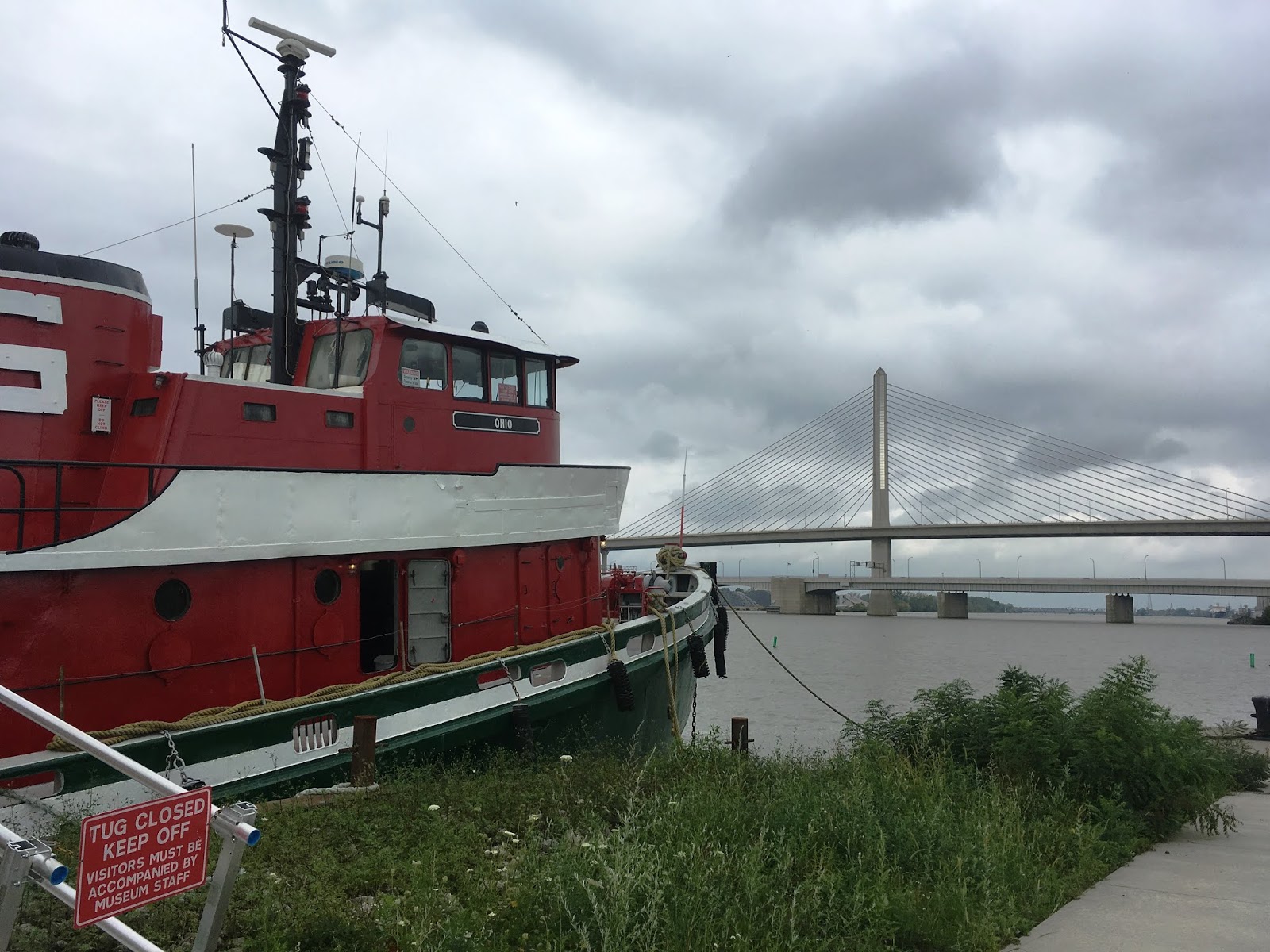
While it is understandable that the swamp greatly impeded travel in the area and produced malaria-carrying mosquitoes, it is still unfortunate that virtually none of the swamp habitat was preserved. Its ecological importance to countless birds and other native species and its role in filtering waters entering the Great Lakes must have been tremendous. There are a few microscopic remnants of the swamp remaining, including Goll Woods State Nature Preserve, a mere 321-acre preserve in western Fulton County. It has been designated a National Natural Landmark and contains 200 to 400 year old trees, remnants from the Great Black Swamp. I was disappointed that I wouldn't have time to travel to this part of Ohio to see the preserve. Instead, I traveled to the mouth of the great Maumee River in Toledo. Here, I toured the National Museum of the Great Lakes which opened in April 2014. The museum offers a chance to tour the 1911 lake freighter, the S.S. Col. James M. Schoonmaker.

The Schoomaker was the flagship of the Shenango Furnace Company and was used for hauling iron ore, grain and coal. The ship was built at the Great Lakes Engineering Works of Ecorse, Michigan and is 617 feet long with a carrying capacity of around 14,000 tons. She sailed as part of the Shenango fleet until 1969 and was sold several times after that ending her run in 1980 after the steel industry took a downturn.
 |
| The Sandusky Star-Journal 03 Jul 1911 |

 |
| Mail delivery |
It takes a good bit of time to tour the entire ship including the engine room, galley, guests quarters, cargo holds, observation deck, bridge, etc., so plan on spending at least 3 hours at the museum if you want to see the exhibits too. One could really spend the entire day browsing the entire museum.
 |
| View of the Toledo Skyway Bridge over the Maumee River from the museum grounds |
My last stop on the trip was Findlay, Hancock County, Ohio where I visted the Oakwoods Nature Preserve and Hancock Historical Museum. Oakwoods Nature Preserve is a 227-acre site with two lakes which are remanants of old quarries that extracted stone for railroad beds. The park opened to the public in 1985. The prairie was established by a local Boy Scout Career Explorer Post from seeds originally collected from other northwest Ohio prairies. There were still lovely late season wildflowers even in October.

My truly final stop before returning home was the nearby Hancock Historical Museum located in the historic Hull-Flater house. There was a lot to see at this museum which has multiple exhibits including the Hull-Flater house (built in 1881 by Jasper and Mary Hull), agricultural building, De-Wald Funk house (Civil War era house relocated to Findlay from Bascom, Ohio), Davis homestead (built circa 1843 and one of the oldest farmhouses left in Hancock County), and the Crawford log house (built in 1840 by Samuel Crawford near the village of West Independence in Biglick Township).
 |
| Dining room in Hull-Flater house |
Jasper G. Hull worked for the Farmer's Bank in Findlay and also purchased half interest in the Findlay Artificial Gas Light Company, which furnished
artificial gas (produced from coal) for the city. However, artificial gas supplies began to run out by 1890 and the industry was eventually swallowed up by the Standard Oil Company monopoly in 1899.
Mr. Hull and family moved to Marion in 1902, and Mr. Hull passed away in 1913 as reported in The Marion Star, Marion, Ohio, 11 Jan 1913.
|
  |
| The Marion Star (Marion, Ohio) · 8 Jul 1902 |
|
Again, it's possible to spend several hours or most of the day here. Northwestern Ohio has a lot to offer in terms of historical sites and I can say it would be very easy to get pulled down rabbit holes learning about historical sites in the region. However, I'm disappointed that there aren't more natural areas in the state that have been preserved for outdoor recreation. Maybe with continued preservation efforts larger areas will be set aside for forest regrowth.