Little Grayback Trail # 921
This trailhead is about a 40 minute drive from Jacksonville and is accessed by Forest Service Road 490. There is a short drive from the Forest Service Road to the trailhead. More details on the 5.4-mile hike (10.8 total miles) are available from the U.S. Forest Service and other websites below. It's an out-and-back hike with an elevation gain of 1,800 feet.
The trail is lightly used, although it appears to be open to OHVs. It winds through a wide range of land forms, including closed forest and glades. It's a nice late season hike due to the sun exposure. We noticed some buggy conditions in the lower part of the trail and several late season butterflies including fritillaries, satyrs, skippers in the open areas. There is no water on the trail. Additional links to this hike:
Da-Ku-Be-Te-De Trail # 940
We only hiked a small part of this trail in early October. The full trail is 4.8 miles and ends at Watkins Campground. The area looks as though it would be crowded during peak months and higher water. The Applegate Lake was only 19% full, which made for very steep slopes along the trail's edge. There are beautiful views of the lake, but the hike is flat and it probably gets heavy use in the peak months. Additional links to this hike:
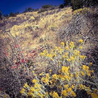
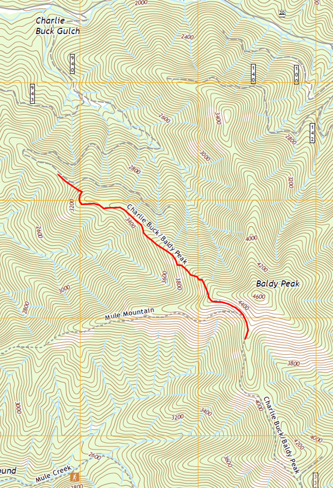
Charlie Buck/Baldy Peak Trail #918
This trail is a steep one, so be prepared and take plenty of water. It would be quite hot in the summer as there are a lot of exposed areas, but it was perfect in mid November. The views are amazing and the steep climb keeps the traffic down. According to the McKee Bridge Historical Society, Charlie Buck was one of seven children of William and Matilda Buck, who came to the Little Applegate from California in 1874. The Charlie Buck Trail is located on Baldy Peak where the family grazed cattle. Additional links to this hike:
Here are the statistics for our hike, which I measured only on the descent:
Distance: 1.6 miles
Duration: 35 minutes
Minimum Elevation: 3088 feet
Maximum Elevation: 4339 feet
Other trail users seen: 0