Showing posts with label utah. Show all posts

6/20/2015

Yampa River - Deerlodge Park to Split Mountain

Whitewater Rafting on the Yampa River - Deerlodge Park to Split Mountain

With no major dams and diversions, the Yampa River is considered one of the last wild rivers in the West. It is the longest free-flowing tributary in the Colorado River basin and the largest tributary to the Green River. Its headwaters begin in the White River National Forest of northeastern Garfield County, Colorado. It is joined by the Little Snake River before entering Dinosaur National Monument and ultimately joins the Green River in Echo Park in extreme northwestern Colorado.

The trip began at Deerlodge Park. From this point, we floated on the Yampa for 46 miles to Echo Park where it joins the Green River. The notable rapids included Teepee Rapid (III), Big Joe Rapid (III) and Warm Springs Rapid (IV).


The Yampa meanders through the Yampa Canyon, with spectacular tilted beds of sandstone. Smooth canyon walls overhang the river in some places towering up to 1,000 feet above the water. We had some rainy weather the first day with a 20 mile float to the first campsite, Big Joe. The weather cleared the next morning giving us the opportunity to explore the area. There were some beautiful rock formations near this campsite a short distance up a small gorge.

Big Joe Campsite

Rock Formations near Big Joe Campsite

The name Yampa is derived from the Snake Indians word for the Perideridia plant --  a tall, grass-like plant in the Parsley family. Yampah was a major food plant of the Native Americans, who would collect its root, dry it, and pound it into a white meal. John C. Frémont recorded the name 'Yampah' in entries of his journal from 1843 (Report of the exploring expedition to the Rocky Mountains in the year 1842 : and to Oregon and north California in the years 1843-44 by Frémont, John Charles, 1813-1890; Torrey, John, 1796-1873; Hall, James, 1811-1898; United States Army Corps of Engineers, Published 1845):
"It grows more abundantly, and in greater luxuriance, on one of the neighboring tributaries of the Colorado than in any other part of this region; and on that stream, to which the Snakes are accustomed to resort every year to procure a supply of their favorite plant, they have bestowed the name of Yampah river."
The second day was a bit rainy again, but short. We stopped to check out a cave known as Signature Cave. There was a lot of graffiti inside the cave made by river runners from the 1930s and 1940s.
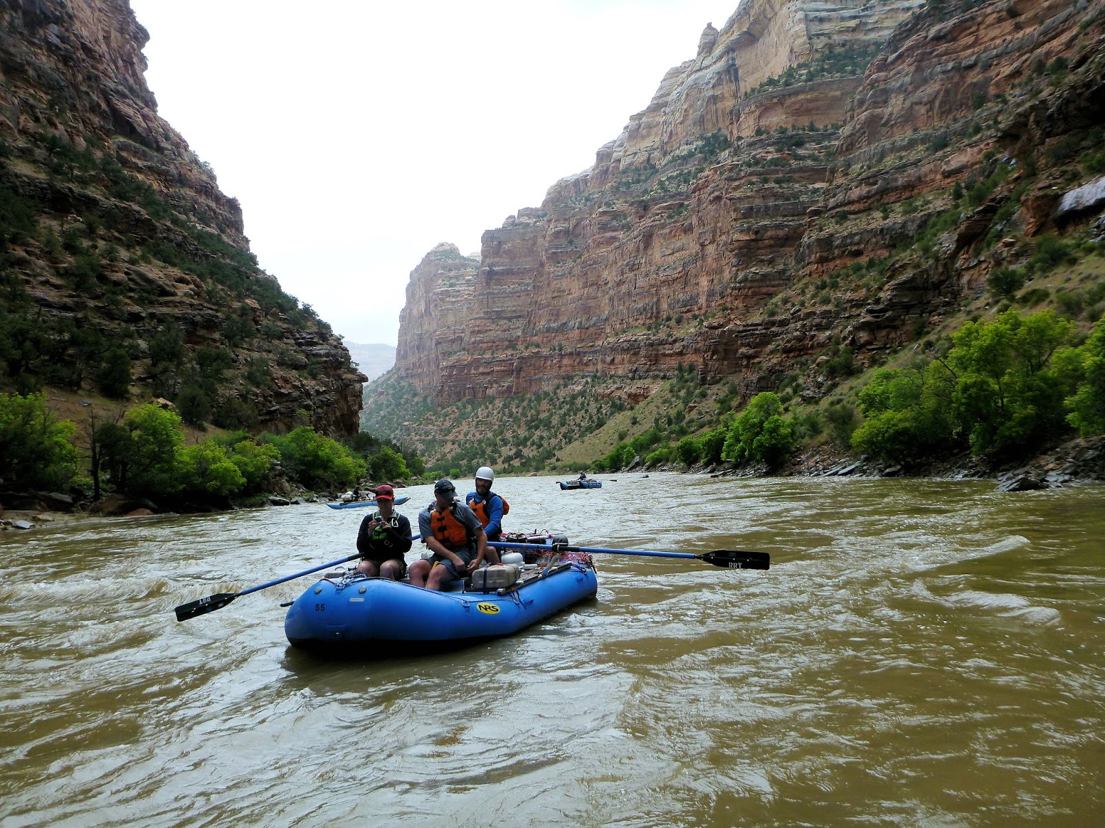

Traveling between Big Joe and Mathers Hole Campsites

View from inside Signature Cave

Mathers Hole campsite was beneath a large overhung cliff that is about 500 feet tall. The area beneath the overhang was sheltered from rain and very sandy -- perfect for horseshoes.


A game of horseshoes beneath Mathers Hole overhang

There were additional opportunities for hiking at Mathers Hole. One of the trails led to the top of the canyon for an incredible view of the river below.


View of Yampa River near Mathers Hole campsite

We spotted several types of birds and signs of beavers. The Yampa River is important spawning habitat for the endangered Razorback sucker (Xyrauchen texanus) and Colorado pikeminnow (Ptychocheilus lucius), the largest minnow in North America, which historically reached lengths of 6 feet. Today they typcially reach lengths of 2-3 feet. Other endangered species in the Yampa River include humpback chub (Gila cypha) and bonytail (Gila elegans)  Eighteen non-native fish species have been introduced some of which include channel catfish, common carp, green sunfish, northern pike, red shiner.

The weather cleared on day three from Mathers Hole campsite to Laddie Park campsite. While it was another short day, the scenery was amazing. Photographs do not come close to capturing the spectacular canyon walls, such as the Grand Overhang and Tiger Wall (actually on day 4 between Laddie Park and Sea Cliff Beach campsites).


Grand Overhang

Tiger Wall

En route to Sea Cliff Beach campsite, we arrived at Warm Springs Rapid, the only class IV on this trip. Apparently the rapid was created in 1965 by a flash flood that washed a debris flow down Warm springs Draw. There is a 1,500 foot cliff here, the tallest on the trip, but most folks were focused on the rapid. The main hazard here is Maytag Hole which can flip boats. Not being a fan of class IVs, I was the only person who chose to walk, but all bodies and boats made it through with no trouble.

A film was released by Friends of the Yampa in November 2014 about the Yampa River and formation of the Warm Springs Rapid. Check it out ONLINE.

Shortly before reaching Sea Cliff Beach, we reached the confluence of the Yampa and Green Rivers.

Confluence of the Yampa and Green Rivers

Christi enjoying the scenery with "Wilson"

The next day, we traveled between Sea Cliff Beach campsite and Jones Hole campsite. Near Jones Hole Creek, there were several trails to hike, one of which led to some 1,000 year-old pictographs created by the Fremont people.

Pictographs by the Fremont People

Checking out the pictographs

There was also a waterfall, which we all found to be entertaining (and refreshing after camping for several days)... and bunnies too!

Karen's turn!

A bunny on the trail

Our last night of camping was at Island Park, near "Bug Island".... eh em... I mean Big Island. There were soooo many mosquitos! Everyone dealt with it in good spirits.

Overall it was an amazing trip and a wonderful group. I didn't take many photos on the water, but I'll end with a small clip taken towards the end of the trip. The flow during the trip was between 7,500 and 8,000 cfs, which seemed just great. Because its natural flooding process is essentially undisturbed, this is definitely a precious natural resource to be protected. I feel so lucky to have had the opportunity to have this experience.


10/09/2013

Utah Rafting: Lodore Canyon on the Green River

Rafting Lodore Canyon on the Green River, Utah: Upper Disaster Falls, Lower Disaster Falls, Hell's Half Mile.... the names of these Green River rapids were not exactly reassuring me, especially after our flip in Westwater a few days earlier. However, I considered myself very lucky to be launching with Jeff and our group of 6 rafts/4 IKs from the Gates of Lodore. Only 300 permits are issued for this trip each year, and the chance of being drawn in the lottery is only around 5 percent. Through a friend of Jeff's, we were able to fill to 2 open slots on the permit for this 44 mile float through an isolated area in Dinosaur National Monument (DNM). We launched from the Gates of Lodore Ranger Station at the northern end of DNM and floated to the Quarry Visitor Center.

Gates of Lodore was named by John Wesley Powell in 1869 after the English poem "Cataract of Lodore." Powell led a team of 9 on a three month geographic expedition down the Green and Colorado Rivers in wooden boats. The expedition, which ran from Green River, Wyoming through the Grand Canyon, was carried out to map the Colorado River's course and collect biological and geological information.

Entering the Canyon: Explorers of years past would characterize these red river waters as "Too thick to drink, too thin to plow." According to the USGS, the Green River transports runoff and sediment from 25,400 square miles in Wyoming, Colorado, and Utah. The river flow is controlled by the Flaming Gorge Dam, which has been in place since 1962. At the time we were there, it was only running between 830 and 1,700 cfs.


Take out on the first day was between Lower Disaster Falls and Harp Falls. The Powell Expedition actually named the Upper and Lower Disaster Falls this way because they lost one of their gear carrying boats here.


The next day we scouted Harp Falls where there was a recent landslide due to heavy rains. The slide didn't alter the channel much and everyone cleared this rapid with no trouble. Afterwards came Hell's Half Mile, the most notable rapid. Fortunately for me, there is a well-worn path around this. I had enough excitement on Westwater so I decided to walk around. This allowed me to film Jeff and the others as they navigated through the technically difficult stretch. Everyone did a great job and there were no mishaps.


While the views were incredible throughout the trip, I thought the most spectacular were from just below Hell's Half Mile to Echo Park. There were stunning rock formations in striking colors. The vegetation was changing into its fall colors, which added to the beauty.


At Echo Park, the Green River converges with the Yampa River, one of the last free-flowing rivers in the Colorado Basin. The reddish brown sediment-laden waters of the Green River join with the Yampa producing a striking visual contrast.


We walked around Echo Park to check out some of the ancient petroglyph panel in the Fremont Indian Style. This panel of petroglyphs was created by forming lines with dots drilled into the rock.


Trip was truly a spectacular experience and something I will never forget. I'm so grateful that my husband and friends gave me such a rare opportunity to see this beautiful landscape.


The Cataract of Lodore
by Robert Southey

"How does the water
Come down at Lodore?"
My little boy asked me
Thus, once on a time;
And moreover he tasked me
To tell him in rhyme.
Anon, at the word,
There first came one daughter,
And then came another,
To second and third
The request of their brother,
And to hear how the water
Comes down at Lodore,
With its rush and its roar,
As many a time
They had seen it before.
So I told them in rhyme,
For of rhymes I had store;
And 'twas in my vocation
For their recreation
That so I should sing;
Because I was Laureate
To them and the King.

From its sources which well
In the tarn on the fell;
From its fountains
In the mountains,
Its rills and its gills;
Through moss and through brake,
It runs and it creeps
For a while, till it sleeps
In its own little lake.
And thence at departing,
Awakening and starting,
It runs through the reeds,
And away it proceeds,
Through meadow and glade,
In sun and in shade,
And through the wood-shelter,
Among crags in its flurry,
Helter-skelter,
Hurry-skurry.
Here it comes sparkling,
And there it lies darkling;
Now smoking and frothing
Its tumult and wrath in,
Till, in this rapid race
On which it is bent,
It reaches the place
Of its steep descent.

The cataract strong
Then plunges along,
Striking and raging
As if a war waging
Its caverns and rocks among;
Rising and leaping,
Sinking and creeping,
Swelling and sweeping,
Showering and springing,
Flying and flinging,
Writhing and ringing,
Eddying and whisking,
Spouting and frisking,
Turning and twisting,
Around and around
With endless rebound:
Smiting and fighting,
A sight to delight in;
Confounding, astounding,
Dizzying and deafening the ear with its sound.

Collecting, projecting,
Receding and speeding,
And shocking and rocking,
And darting and parting,
And threading and spreading,
And whizzing and hissing,
And dripping and skipping,
And hitting and splitting,
And shining and twining,
And rattling and battling,
And shaking and quaking,
And pouring and roaring,
And waving and raving,
And tossing and crossing,
And flowing and going,
And running and stunning,
And foaming and roaming,
And dinning and spinning,
And dropping and hopping,
And working and jerking,
And guggling and struggling,
And heaving and cleaving,
And moaning and groaning;

And glittering and frittering,
And gathering and feathering,
And whitening and brightening,
And quivering and shivering,
And hurrying and skurrying,
And thundering and floundering;

Dividing and gliding and sliding,
And falling and brawling and sprawling,
And driving and riving and striving,
And sprinkling and twinkling and wrinkling,
And sounding and bounding and rounding,
And bubbling and troubling and doubling,
And grumbling and rumbling and tumbling,
And clattering and battering and shattering;

Retreating and beating and meeting and sheeting,
Delaying and straying and playing and spraying,
Advancing and prancing and glancing and dancing,
Recoiling, turmoiling and toiling and boiling,
And gleaming and streaming and steaming and beaming,
And rushing and flushing and brushing and gushing,
And flapping and rapping and clapping and slapping,
And curling and whirling and purling and twirling,
And thumping and plumping and bumping and jumping,
And dashing and flashing and splashing and clashing;
And so never ending, but always descending,
Sounds and motions for ever and ever are blending
All at once and all o'er, with a mighty uproar, 
And this way the water comes down at Lodore.


10/04/2013

Utah Rafting: Westwater Canyon

Rafting Westwater Canyon, Colorado River: Westwater Canyon is located on the Colorado River and includes the 17-mile segment between the Utah/Colorado state line and Cisco, Utah. I found that in nearly every conversation with other rafters about this Canyon, the first two questions are inevitably (1) What did you run it at? and (2) Did you end up in the "Room of Doom?" We ran the Colorado River through Westwater Canyon (well... Jeff ran it, as I was merely a useless passenger perched on and clinging to the dry box) at around 6,300 cfs. This river can reach peak flows of 20,000 cfs, but higher flows tend to wash out the big rapids. Flows at or above 9,000 cfs, are called the "Terrible Teens" because the rapids can be particularly tricky and there are more serious consequences if losing control.

On our trip, recent rains had made the water an opaque, milk chocolate soup shaded by towering Precambrian walls of the inner canyon. Westwater Canyon starts out very gentle and wide but becomes a narrow canyon, where the Colorado river rushes through with violent rapids from river rocks and steep cliffs on both sides. Once you enter the canyon, you are committed.


We made it through Funnel Falls and then entered Skull Rapid on a wave train. Skull Rapid has a large hole where all of the water converges. The rafters in this video cleared the hole that we went into sideways and flipped in.


I ended up underneath the boat, and due to the strong current, headed straight for the sheer canyon wall after finding my way to the surface. As I understand from our companions, I nearly ended up in the "room." According to American Whitewater, the "Room of Doom" in Westwater Canyon is "formed where a rock point protrudes out into the main current. Most of the flow continues downstream to the left but a significant portion heads right into a rock alcove with a powerful recirculating current that prevents boats from accessing the main current.... There have been cases where groups have actually had to dismantle their raft and portage up over the cliff."

The current slammed me into the wall and a pillow sucked me underneath the water again. When I came back up I saw Jeff hanging onto the boat and swam to it. We both had hold of the boat and continued floating downstream until we saw another group of rafters on shore holding out paddle handles. I was so grateful to see them. We had floated toward the edge where they were standing. They were there because 4 crew members fell out of their raft though they did not flip.

After recovering and righting our boat, we had no choice but to continue on downstream. Our boat was tossed around again in Sock-it-to-me Rapid, which is just after Skull. I was pretty much freaking out at this point so I insisted on walking around Last Chance Rapid. I came to realize, however, that this wasn't a good idea. The rock walls are so sheer, there are few places to access the river. I was fortunate to find a small spot to climb down - otherwise, I would have had to jump back into the river from a high point on the rocks. We made it through and camped at Big Horn campsite.


The second day was mostly flat water, but the wind was howling!


It was nearly impossible to row downstream because the winds were pushing us upstream. It took quite a bit of time and rowing power just to make it to Cisco. There were a few breaks where we were able to check out the rock formations many of which had swallow nests clinging to the sides.


Next, we would be heading to the Gates of Lodore in Dinosaur National Monument to row down the Green River.