Jack Ash Trail
This is a large trail system known as the Jacksonville to Ashland Trail, or "Jack-Ash Trail." Since 2009, the trail has been a project of the Siskiyou Upland Trails Association and is partially completed. We divided our exploration of the trail into three sections, Lower, Middle and Upper Jack Ash Trail, shown in the map below:

Jack Ash Trail, Lower Segment
We had fun snowshoeing on the Lower segment over the holidays. This section is a moderate climb with decent views through the trees. We didn't encounter any other hikers. The trail is accessed from Griffin Lane, named for pioneer Captain B. B. Griffin who settled in the Rogue River Valley in 1852.
 |  |
 |  |

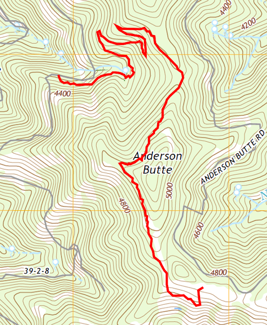
Jack Ash Trail, Upper Segment
This Upper segment was part of Phase I of the Jack Ash trail and opened in 2017. Phase 2 will connect to the Jacksonville, Ashland, and Applegate Ridge Trail systems. Here are our statistics for this hike which can also be accessed by Anderson Butte Road:
Distance: 3.4 miles
Duration: 1 hours, 22 minutes
Minimum Elevation: 4269 feet
Maximum Elevation: 5019 feet
Other trail users seen: 0
 |  |
 |  |