11/08/2019

Some Commercial History of North Central and Northwestern Ohio

I recently had the pleasure of visiting north central and northwestern Ohio including Seneca, Hancock, and Lucas Counties. I was pleased to find that residents were willing to share stories of the region's commercial history and am taking advantage of their hospitality by summarizing some of what I learned. I had only three days to explore and, as such, merely scratched the surface of what could have been uncovered if I had put forth a more vigorous effort. I began my tour in Seneca County, which was founded in 1820 from Huron County. Tiffin, the county seat, was founded by Josiah Hedges in the year 1821. It's said that Governor Edward Tiffin of Chillicothe was a friend of Josiah Hedges, who named the town after his friend.

I started by exploring the Sanborn Fire Insurance map from Tiffin to see what was going on in the area during the late 19th century.  The area along the Sandusky River on River Street (now Riverside Drive) was developed with G.W. Keller Flour Mills/Pearl Mills, Brickner & Ehrenfried Distillery and Schumann's Brewery. The flour mill, reportedly built by Josiah Hedges in 1822, is now known as the Pioneer Mill restaurant. This mill company was the first major industry in Tiffin. It began grinding in 1824 and was operated by Josiah Hedges' son-in-law operated until 1848 when it was transferred to William Hunter. Hunter sold the mill to Gottfied Diemer in 1864, and in 1866 it was purchased by Ruben Keller. Fire destroyed the original frame structure 1874 and Keller rebuilt it.

1887 Sanborn Fire Insurance map of Tiffin, OH
Other former owners include George and Edward Cunningham, Joel Keller, George Keller, Henry and Sheldon Houser, Ervin Graves, and Frank W. Bacon who purchased the mill in 1902. Another fire damaged the mill in the 1930s. The mill reportedly ceased operations around 1950.

The Tiffin Tribune, Sep 3, 1869

The Tiffin Tribune, Aug 15, 1872
Mill in 1909 (from the Seneca County Digital Library)

Hedges-Hunter-Keller-Bacon Gristmill in 2019 (110 years later)
The Sandusky Register April 28, 1937
Further south at 215 Riverside Drive was the Brickner and Ehrenfried whiskey distillery (constructed at the site of the former Wagner-Brickner No. 51 distillery). This is Tiffin's only known distillery and is still standing! The present structure was estimated to have been built between 1873 and 1881 by Cyrus Bowman and is also known as Bowman's Distllery.

The Tiffin Tribune, Oct 17, 1872
In the 1887 Sanborn map, it is listed as the Brickner & Ehrenfried distillery. John Baptiste Ehrenfried (1845-1922), and Andrew J. Brickner were born in Bavaria, Germany, and both had several business enterprises within the Tiffin community. The distillery operated until around 1890 and subsequently became The Pure Soap & Toilet Co. by 1908 and Tiffin Robe and Tanning Co. by (1920-1934). Ownership of the leather operation was taken over by A.J. and J.O. Pilar (1936-1942). Riverside Furniture Company operated in this building from around 1956 to 1971. 


Next door to the distillery was the former Clinton/Mueller/Phillip Gummel Brewery/Schumann & Company Bavarian Brewery/Tiffin Brewing Company. The building has a fascinating history which was passed on to us by the owner who graciously gave us an impromptu tour.

1874


The building represents the German heritage of Tiffin. Mueller and Schmidt established a lager brewery in Tiffin in 1848, which is said to be the first lager beer brewery in Ohio. In 1854, they constructed the structure on River Road and moved their enterprise to this location. In 1885, Philip Grummel bought the operation and brewer's house next door, known as the Christ Mueller house. The business was known as the Tiffin Brewing Company from 1889 to 1915. The Grummels never resumed the operation after prohibition ended, and the structure was used for the Grummel Bros. Ice and Beverage Company. In 1925, Tiffin Scenic Studios Inc. moved into a part of the building. They still occupy this location today! The firm makes stage scenery and rigging for a national market.

Christ Mueller House - Mueller lived here until 1885 when much of his land, including this house, was transferred to Philip Grummel at a sheriff's sale
A cooper's pond was formerly located immediately north of the present building. The brewery made its own barrels for beer and used the pond to soak barrel staves. The pond disappeared by 1925. Just north of the pond was a brick structure used as a stable.

Former brewery stable
One "fun fact" about this brewery is that it contains underground tunnels (now walled shut at the river bank and brewery entrance) that used to run from the brewery across the road to a malt house. The tunnel was used to transport beer across the road to the river to avoid the tax for transporting it over the road. Horses and wagons were used to get supplies to and from the river, and the old wagon entrance on the rear of the building (now walled shut) is still visible. During the World Wars, the tunnel was used to grow mushrooms, which were harvested for commercial purposes. The opening on the riverbank may still be visible, although the river now extends all of the way to River Road.

 Brewery Layout in 1887 - Notice the malt house across the river
 
The former malt house - from Images of America: Tiffin, Ohio

Underground tunnels!
After touring the brewery, we were pointed in the direction of another commercial structure with an intriguing history - the Kildow building on East Perry Street. The three-story building on East Perry Street was built to house the W.H. Kildow Cigar Company, established in 1892. The Kildows operated the cigar business for 40 years. William Kildow passed away in 1936 and his sons continued the business. In 1944, manufacturing was discontinued but son Thomas Monroe Kildow maintained a wholesale cigar and candy business at this location. It is presently the Antique Warehouse.

W.H. Kildow building on East Perry Street in Tiffin, Ohio

20 Jan 1944 - The Evening Independent
(Massillon, Ohio)


Much of the building is unaltered and we were informed that the original colors were used when repainting the tin ceiling on the first floor.


There were other interesting bits of history still intact, including the original employee bathrooms and original wooden stair steps worn in the middle from continuous use.

Next on the list was the former Ohio Lantern Works (formerly the Tiffin Tool Company building) and Hotel Berlin buildings shown here on the 1896 Sanborn map. The Tiffin Tool Company manufactured farm and garden implements but was only in business for a few years until 1889. The building was constructed between 1883 and 1885.


1896 Sanborn Map

The Ohio Lantern Co. was reorganized from the Buckeye Lantern Company in Bellaire, Ohio (est 1838) by Alfred L. Baron and B.F. Cockayne during the natural gas boom in northwestern Ohio. The company was first relocated to Findlay, Ohio and then moved again to Tiffin in 1889. The factory was strategically located on the railway line. A. Baron died in 1904 and his son, Charles, managed the plant. They plant produced tubular lanterns, desk lanterns, wire-cushioned oil cans, and other metal stamping products. "Baron Lanterns" were sold around the world and noted for their reliability. The company ceased operations in 1949 and Ohio Power Company operated its service department here. It was then used for storage from 1956 to 1968, and Standard Roofing and Sheet Metal Supply occupied the structure in the 1970s. It is currently occupied by Sealed & Striped of Tiffin, a line marking service.


Some examples of early lanterns manufactured here can be found online:


Belmont Chronicle (Saint Clairsville, Ohio) · 31 Oct 1878


Specifications and Drawings of Patents Issued from the U.S. Patent Office January 1, 1872
The Hotel Berlin building is a bit more obscure. It is depicted on the 1896 and 1901 Sanborn maps on the corner of Lafayette and Hudson Streets. It is shown as an apartment building in 1908 and later. It would probably take access to historical documents, which I do not have available to me, to dig up more information on the former hotel as it was short-lived. But, a lovely building nevertheless.


There are many more historical buildings to view in this city, and many are listed on the National Register of Historic Places for Seneca County. I ended the day at the Seneca County Historical Museum, which is in the former home of local businessman, Rezin W. Shawhan. The house was built in 1853 and donated to the county in 1941.


The museum has excellent exhibits including Tiffin and Beatty Glass, early furniture handcrafted by Seneca County pioneers, linens and artifacts, and a educational display on the Junior Order United American Mechanics National Orphans Home which we decided to visit afterwards. The museum is highly recommended.

Beatty Glass exhibit at the Seneca County Museum

The Junior Order Home orphanage was established in 1896 and closed in 1944. It began as a single farm residence with three children and grew into a self-supporting community with about 1,200 residents in its peak years (1930-1937). The 200-acre campus had residence cottages, a chapel, gymnasium, grade and high schools, vocational school, hospital, dining hall, bank, post office, nursery, library, laundry, cannery, power plant and administrative building. The superintendent was Charles Kernan. A former orphan himself, Mr. Kernan moved to Tiffin in 1901 and built the operations at the orphanage around the hope of a normal family life. No children at the orphanage were sent out for adoption and all children had the opportunity for an education.

Residence cottages at the Junior Order Home
According to an article in The Dayton Herald (22 Aug 1944), the State of Ohio acquired the orphanage in 1944.

The following day, I decided to explore an area of northwestern Ohio formerly known as "The Great Black Swamp." The densely forested swamp, which once covered the region from Sandusky to Findlay, and west to Fort Wayne, Indiana (approximately a million acres), was a wetland formed by the retreating glaciers. In the 1850s there was an organized attempt to drain the swamp for agricultural use and travel. Not much remains of the swamp, although restoration efforts are proposed as a means of reducing agricultural runoff into Lake Erie, which is once again suffering from serious water quality issues.

Western Reserve Chronicle (Warren, OH) 01 Aug 1855
While it is understandable that the swamp greatly impeded travel in the area and produced malaria-carrying mosquitoes, it is still unfortunate that virtually none of the swamp habitat was preserved. Its ecological importance to countless birds and other native species and its role in filtering waters entering the Great Lakes must have been tremendous. There are a few microscopic remnants of the swamp remaining, including Goll Woods State Nature Preserve, a mere 321-acre preserve in western Fulton County. It has been designated a National Natural Landmark and contains 200 to 400 year old trees, remnants from the Great Black Swamp. I was disappointed that I wouldn't have time to travel to this part of Ohio to see the preserve. Instead, I traveled to the mouth of the great Maumee River in Toledo. Here, I toured the National Museum of the Great Lakes which opened in April 2014. The museum offers a chance to tour the 1911 lake freighter, the S.S. Col. James M. Schoonmaker.


The Schoomaker was the flagship of the Shenango Furnace Company and was used for hauling iron ore, grain and coal.  The ship was built at the Great Lakes Engineering Works of Ecorse, Michigan and is 617 feet long with a carrying capacity of around 14,000 tons. She sailed as part of the Shenango fleet until 1969 and was sold several times after that ending her run in 1980 after the steel industry took a downturn.

The Sandusky Star-Journal 03 Jul 1911


Col. James M Schoonmaker prior to launch in 1911 - Detroit Publishing Co.
Mail delivery

It takes a good bit of time to tour the entire ship including the engine room, galley, guests quarters, cargo holds, observation deck, bridge, etc., so plan on spending at least 3 hours at the museum if you want to see the exhibits too. One could really spend the entire day browsing the entire museum.

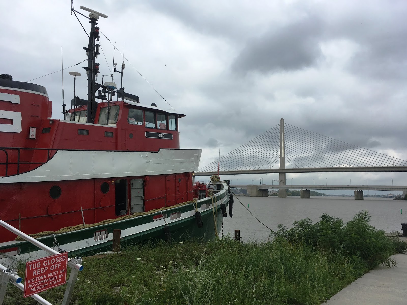
View of the Toledo Skyway Bridge over the Maumee River from the museum grounds
My last stop on the trip was Findlay, Hancock County, Ohio where I visted the Oakwoods Nature Preserve and Hancock Historical Museum. Oakwoods Nature Preserve is a 227-acre site with two lakes which are remanants of old quarries that extracted stone for railroad beds. The park opened to the public in 1985. The prairie was established by a local Boy Scout Career Explorer Post from seeds originally collected from other northwest Ohio prairies. There were still lovely late season wildflowers even in October.


My truly final stop before returning home was the nearby Hancock Historical Museum located in the historic Hull-Flater house. There was a lot to see at this museum which has multiple exhibits including the Hull-Flater house (built in 1881 by Jasper and Mary Hull), agricultural building, De-Wald Funk house (Civil War era house relocated to Findlay from Bascom, Ohio), Davis homestead (built circa 1843 and one of the oldest farmhouses left in Hancock County), and the Crawford log house (built in 1840 by Samuel Crawford near the village of West Independence in Biglick Township).

Dining room in Hull-Flater house
Jasper G. Hull worked for the Farmer's Bank in Findlay and also purchased half interest in the Findlay Artificial Gas Light Company, which furnished artificial gas (produced from coal) for the city. However, artificial gas supplies began to run out by 1890 and the industry was eventually swallowed up by the Standard Oil Company monopoly in 1899.

Hull-Flater House in 1903 - Hancock Historical Museum
Mr. Hull and family moved to Marion in 1902, and Mr. Hull passed away in 1913 as reported in The Marion Star, Marion, Ohio, 11 Jan 1913.

Jasper Girard Hull from Find A Grave memorial

The Marion Star (Marion, Ohio) · 8 Jul 1902
Again, it's possible to spend several hours or most of the day here. Northwestern Ohio has a lot to offer in terms of historical sites and I can say it would be very easy to get pulled down rabbit holes learning about historical sites in the region. However, I'm disappointed that there aren't more natural areas in the state that have been preserved for outdoor recreation. Maybe with continued preservation efforts larger areas will be set aside for forest regrowth.


3/06/2019

The Big Road: Oregon's Stagecoach Route

I was inspired by a book by Gary and Gloria Meier, called "Knights of the Whip," to seek out the remaining stagecoach stations on the old stage road known as the "Big Road." The Big Road was a route between Oregon and California used by native Americans, fur trappers, gold prospectors, military, and pioneers. It started as a pack trail and was developed into a wagon road by Jesse Applegate and others. It received appropriations in 1857 for improvements, as it was essential for military operations. Once it was improved to a condition in which heavy wagons could pass with less difficulty, the earliest commercial stage lines were established. On September 15, 1860, the California Stage Company made its inaugural run between Sacramento, California and Portland, Oregon.

Stage stations provided services for the customers and held a reserve stock of stage horses. Most of the stations were privately owned and run by pioneer families, on their Donation Land Claim properties, who contracted with the stage company and got reimbursed for their services. Starting on the Oregon-California border, we tracked down the southern Oregon stations:

Route between Cole's and Barron's Stations in Southern Oregon
The last stage stop in California before going over the Siskiyou Mountains into Oregon (and the first we visited heading north) was Cole's Station. Cole's Station is still standing and can be seen by taking Exit 796 on Interstate 5. Travel west on Hilt Road and take a right in the town of Hilt to stay on Hilt Road. The road runs to the northwest parallel to the railroad tracks and turns into Colestine Road. Cole's Station is one mile up Hilt Road on the right. The stage barn is visible on the left across the road. Cole's was established by Rufus Cole who headed west from Putnam County, New York in 1851 with his brother Byron to search for gold. Both homesteaded ranches in the Colestin Valley under the Donation Land Claim Act of 1850. Rufus built his home next to the Hudson's Bay Pack Trail which became a territorial road in 1855. He used his home at the first location as a stage station until he moved it south to the present location in 1859. The station served as a regular stagecoach stop for around 30 years.

Cole's Station in 1887

The above photo is from "Pioneers of the Colestin Valley"in Southern Oregon Heritage Today, November 1999, Vol. 1 No. 11. Today, the home is a private residence.

Cole's Station in 2019

Stage Barn at Cole's

The next stage stop in Oregon was Barron's Station, with nearby Casey's and Kingsbury's stations, both of which operated at times either when Barron did not contract for stage station services (Casey's) and for a short period after Barron closed his station in 1884 at the end of the stage days (Kingsbury's). Barron's was the first station on the Oregon side of the Siskiyou Mountains.

A biographical sketch of Major Hugh F. Barron was printed in The Oregon Sentinel on Wednesday, March 5, 1879. Major Barron lived with his wife, Martha, in a log cabin until he built a home on the same site in 1858. He acquired a second home, built by James Russell and James Gibbs, for his expanding cattle and sheep ranch. It was this home that became Barron's Station and was located about a quarter-mile north of his first farm house. The second house had already been used as a stage station, and Barron developed it into the "Mountain House" station where his wife was hostess.

The house, presently a private residence at 1148 Old Hwy 99 S, still stands today and can be seen by driving south on Highway 66 toward Emigrant Lake to the Old Siskiyou Highway. Turn right and the house is a quarter-mile on the right. The stage barn was formerly located across the road but no longer exists. In addition, Casey's and Kingsbury's stations no longer exist.

Barron's Station in 2019


The next few stations no longer exist, but we visited the old locations nonetheless:

Route between Barron's and Amerman's Station

Ashland Mills was not an official stage stop as it was only five miles from Amerman's. However, the stagecoach ran along what is now East Main Street, and many passengers stayed the night here. The earliest hotel was known as the "Ashland House," built in the year 1859 by Eber Emery at a cost of $3,000. Emery kept the hotel for 10 years and then sold to Abel Helman, and then to Jasper Houck. The hotel, located across from the I.O.O.F. Building, was demolished in the late 1910s. Images of the former hotel below are from the Southern Oregon Historical Society and from an Archaeological Survey of the Ashland Plaza conducted in 2013. The Ashland House was moved at least twice prior to its demolition. Once, a short distance at the Plaza, and a second time several blocks away to the Town’s Railroad District. Highway 99 and N Main Street now run through the former location.

Ashland House Hotel circa 1867 from "Ashland Plaza: Report on Findings of the 2012-2013 Sub-Surface Archaeological Survey of the Ashland Plaza Project Area Jackson County, Oregon" by Jeff LaLande

Ashland House Hotel in 1880s
Ashland Weekly Tidings - 28 Dec 1921


Amerman's Station was located the present location of 5595 Pacific Hwy, about one mile south of Phoenix, Oregon. Phoenix was known at that time as Gasburg. James Amerman was born around 1824 in Huron County, Ohio. It is believed that he may have come to Oregon in 1852 with his brother, Henry. Amerman purchased 320 acres of farm property from the original Donation Land Claim owner. He started offering stagecoach services in 1860 and passed away in 1871. His widow, Elizabeth, married William S. Stone, superintendent of the O & C Stage Company, on February 22, 1874 and the two kept the station operating. Oatman's Station was a mile north of Amerman's and also no longer exists.

Jacksonville was an important hub for the stagecoach in Southern Oregon. There were many structures dedicated to stagecoach operations, which were owned by the California Stage Company. Several hotels operated in Jacksonville, including the Union Hotel (later known as the United States Hotel) at California and 3rd Streets. The United States Hotel burned in 1873 and the Old Franco-American Hotel on Oregon and Main Streets, owned by Jeanne DeRoboam Holt became the official stop. Ms. Holt later purchased the burned United States Hotel and converted it into an elegant hotel which opened on November 19, 1880 and stands today. Unfortunately, the O&C Stage Company decided to make the official stop at the New State Hotel across the street from Ms. Holt's hotel. The Old Franco American Hotel burned in 1886.

From "Pictures in Time" by the Southern Oregon Historical Society
United States Hotel building in 2019
Route between Amerman's Station and Croxton's Station


The next stop north of Jacksonville was the community of Rock Point. The Rock Point community was founded by J.B. White in the early 1850s. J.B. fought in the Rogue Indian Wars, and in exchange for his service, he received land on which he developed a homestead on the south side of the Rogue River. A flood in 1861-1862 destroyed the bridge over the Rogue River and his home on the south side. He moved his home to the north side of the river and, in 1863, decided to open a store and sold the property to L.J. White (no relation). L.J. immediately began constructing a new bridge and stage station called the Rock Point Hotel in 1864.  On February 8, 1865, the hotel opened to the public with a grand ball. Lytte White died on October 28, 1878 and his sons and wife continued to run the stage stop at Rock Point. His son Henry bought out his mother and brothers and renovated the old hotel in 1887. But, by the turn of the century the hotel had closed and Henry had returned to farming. The building was purchased in 1907 by orchardist F. K. Deuel and others. It is the current site of Del Rio Vineyards and Winery.

Rock Point Hotel in 2019

Croxton's Station was 14 miles north of the Rock Point Station near 7th Street and Savage in current Grants Pass, Oregon. A newspaper article dated October 31, 1974 says the location was farther north, near Interstate 5 at about Vine and Highland Avenues. Thomas Frederick Croxton arrived in Illinois from Staffordshire, England in 1843 with his wife Hannah Box and seven children.  In 1849, he traveled to the west to try gold mining and was a traveling Methodist preacher before moving to Josephine County in 1857 to continue prospecting for gold. He acquired the property for the stage station in 1864 and began operating it with the help of his son-in-law, Ebenezer Dimmick. There was an earlier station just north of Grants Pass called Louse Creek Station, but the station was closed when the Big Road was re-routed to an easier grade over Merlin Hill (the present Interstate 5). After his wife died in 1866, Thomas Croxton became a pastor in Coos Bay, which was then known as Marshfield.  Ebenezer Dimmick continued operating the stage station until the end of the stage days. Nothing remains of the station, but Croxton's home is still standing (built 1866) at 1002 Northwest Washington Boulevard in Grants Pass. Croxton died in 1868.

Route from Grants Pass to Canyonville


The Grave Creek House was the next stop located 13 miles north of Croxton's. Formerly a region of conflict with the Native Cow Creek Umpqua tribe, James H. Twogood came to the site in 1851 to lay out his Donation Land Claim. He called the land “Grave Creek Ranch,” in memory of pioneers who perished there traveling north to Portland in 1846. Oregon Legislature passed an act renaming Grave Creek to Leland Creek in January 1854. By 1855, Twogood and McDonough Harkness acquired a former rest house (Grave Creek House #1 / 1854) for Applegate Trail travelers along Grave Creek, built a hotel, and contracted with the O&C Stage Company as a stage stop in 1860. A new hotel known as the Grave House #2 (1860) operated until it burned down in 1875. Then, a nearby farmhouse was enlarged enough to accommodate the stage company and was known as the Grave Creek House #3 (1876) or Harkness Inn. The Hugo Neighborhood Association provides a brochure with details on the station. The Grave Creek House stood just to the east of what is the old Pacific Highway (US-99) and north of today’s Grave Creek covered bridge. The Grave Creek covered bridge still stands and is off Interstate 5, Exit 71 with a marker providing history on the Grave Creek ranch.

Location of former Grave Creek House

Grave Creek House (later, Leland Creek House) from Josephine County Historical Society/Larry McLane

Wolf Creek Tavern was not an official stagecoach stop, but the roadside inn was used by other travelers en route to Southern Oregon and California.The hotel was the stopping place of President Hayes on his first trip to Oregon. According to a 1948 article in The News-Review and other sources, it is claimed that Ulysses Grant, Clark Gable, John Wayne, Jack London and author Sinclair Lewis stayed at the lodge, and one of the first three lodges of the I.O.O.F. was reportedly organized in its attic. The stage stop still operates as a restaurant and is listed on the National Register of Historic Places.

Wolf Creek Tavern in 2018
Dining Area at Wolf Creek Tavern

Established by pioneer Daniel Levens, the Levens Station was situated 13 miles north of Grave Creek and was a home station for drivers. Mr. Levens was active in other businesses including a store, hotel and grist mill in Canyonville. Levens re-built his original stage house in 1880 with a larger and more elaborate structure. Fred Tice drove the stage in 1878 and 1880 from Rock Point to Levens Station, a 45 mile drive on the old stage route. Tice lost a six-horse team by spring flood waters in Cow Creek on March 4, 1879 during the night (Medford Mail Tribune, 1 Sep 1931). There were few bridges at that time and fording was common. The Levens Station burned to the ground in 1931 according to The News-Review, 16 Mar 1932.


The Overland Hotel, formerly known as the Canyonville Hotel, was located on the corner of what was once Washington and 1st Streets (now 5th and Main) in Canyonville, Oregon. The hotel was built in the 1860s by John Arzner and George Wagner. It was originally constructed for a lodge room and store and was later used as a hotel because the emigrant stage travel became so heavy that another hotel was needed. It was run by David McCallen and his wife Electa between 1865 and 1867, and by William and Christina Spicer in the 1870s. William Spicer died in 1876 and his wife continued to run the stage stop until it was purchased by William Briggs in 1886. The Briggs family kept the property which was converted back into a grocery store until it was partially torn down in the 1950s.

The News-Review, Roseburg, Oregon, 25 Nov 1940

We traveled as far as Canyonville but will save the rest of the route north to Portland for another time!

7/15/2018

Applegate Ridge Trail (ART) East

Recently opened in July 2017, this section of the Applegate Ridge Trail (ART) is a 5.6 mile stretch on the eastern end of the proposed 50-mile trail. We hiked this section on two separate days. The first day we entered the trail from Highway 238, about five miles south of Jacksonville. Presently, there is no established parking area at this trailhead, so it is necessary to park along the highway. The gate to the trail is on the east side of the highway. There isn't a sign for the trailhead yet, so it is a little tricky to locate (42.269906, -123.024205). We parked on the west side in order to avoid blocking the gate. Here's what it looks like from the highway (southbound):

Street View of East ART entrance gate (identified with orange arrow) from Highway 238
Applegate Trails Association provides a map of the trail here. It is a moderate climb starting from this side, but the remarkable scenery is worth the effort. Following the ridge tops above the Poorman and Bishop Creek drainages, the trail has a variety of wildflowers and grasses, sun-baked south-facing slopes, and cool sections shaded by large Douglas fir and madrone.


A notable pioneer from this area is George Black who staked his claim on Poorman's Creek.

GEORGE BLACK: lives on Poorman's Creek; is a native of County Down, Ireland; came to Oregon in 1851 and to Jackson County in 1852; is one of the pioneer miners of this country, which calling he still pursues.
~A. G. Walling, History of Southern Oregon, 1884, page 501

After about an hour you will reach a stunning view of the Applegate Valley.


The hike back down (if you do decide to return at this point) is an easy downhill trip. Other points of interest in the area include the Log Town Cemetery located about 1.75 miles south of the ART East trailhead on the east side of Highway 238. The first burials in this Cemetery were made in the 1850s when a busy gold mining camp was in existence along the Jacksonville-Crescent City trail (now Hwy 238). The highway today largely follows the old trail and wagon road, which was established to transport supplies to the mining camps in the area.

On another day, we hiked this trail entering from the western access point off Sterling Creek Road, which has a parking lot, trailhead kiosk, and picnic table.  The views coming from the west are equally stunning.


It is a relatively easy hike, as the trail winds along the mountain side. Some areas of quartz are visible near the beginning of the trail, a reminder that you are in gold country. The Sterling mine, owned by the Sterling Mining Co. incorporated in 1877, was located on Sterling Creek, a branch of Little Applegate River. It was, at one time, the largest hydraulic mine in the state, possibly the western U.S. The gold from this region was high in silver giving it a pale color. During this time, large areas of the riverbeds of Sterling Creek and the lower Little Applegate River were excavated.

The Medford Mail - November 27, 1903


You will most certainly be inspired by the natural beauty of this area. Due to its complex terrain, geology, climate, and biogeographic history, this region of southern Oregon (the Klamath-Siskiyou Ecoregion), is considered to be a global center of biodiversity (Wallace 1982). The region most certainly deserves our attention and protection for future generations.


3/08/2018

Taverns in Historical Buildings -- Southern Oregon

While the first Euro-American settlers came to southern Oregon as trappers, urban development in Southern Oregon was initially driven by the California Gold Rush. Many Oregon prospectors streamed to the area from the Willamette Valley in 1848-1849 after word of a gold strike at Sutter's Mill spread throughout the country. Additional discoveries in the Illinois Valley (known as "Sailor's Diggings"), Waldo, Rich Gulch, and Althouse established the importance of the area as a gold mining region. A small mining camp at the head of the confluence of Jackson and Daisy Creeks quickly developed into the town of Jacksonville, and the town was named the county seat in 1852.

There's a lot of history to explore in the Rogue River Valley, and having a solid list of pubs while visiting the area is essential. What's even better is visiting an establishment that is situated in a historical landmark. We've scoured the area for some the best pubs in historical buildings to try.

1. Homestead Pub & Restaurant (119 E Main Street in Rogue River). Originally named Woodville, the town of Rogue River began with a river crossing, known as Evans Ferry, along the California-Oregon Trail. The ferry was set up during the gold rush days of the 1850s. When Mark Whipple opened the Homestead Tavern in 1906, he had a booming business until Prohibition was enacted in 1914. The tavern was converted into a grocery store, cafe and real estate office until 1933 when Prohibition was repealed. Ward Wills, who ran the cafe, converted the market back into a pool hall and bar and named the entire complex the "Homestead" in 1935.

Historical Image from "Rogue River" By Cheryl Martin Sund

The Homestead Pub still has the large neon "H" sign that was added in the 1960s.  Currently the Homestead bills itself as a pub AND restaurant even though it still appears to be more the former than the later. The bar has live music weekly with shuffleboard and pool tables. The menu was standard pub fare, burgers, sandwiches (with excellent French fries), but slim pickins' for vegetarians with only one option.  There is full bar with about 8 beer taps that are dominated by Bud-Miller-Coors monopoly however they do offer a couple good local craft beers.  The friendly clientele is what you would expect from any Southern Oregon dive bar, gravelly-voiced eye-patch-wearing grandmas rubbing elbows with local pot farmers.


2. J'ville Tavern (125 W California Street, Jacksonville). Built in 1856, the J'ville Tavern at 125 W California St, Jacksonville was originally a general merchandise store named Anderson & Glenn General Merchandise. One of the first merchants to sell supplies to the area's gold seekers, John Anderson established his business in this small, rectangular fireproof brick building. The store survived two of Jacksonville's major fires in 1874 and 1884. Anderson joined in partnership with James Glenn, large landowner and town treasurer, in 1859. The men continued to operate a dry goods store here until 1866 or 1867, when the business became Glenn, Drum and Co. In the 1870s, the business operated as Martin and Drum, and then as White and Martin. However, John Anderson maintained ownership of the building until 1877 when it was sold by his widow to Louis Solomon. It was used continuously as a merchandise store until the turn of the century.

Bird's Eye View of Jacksonville 1883 from the Library of Congress

While several businesses have operated here, the J'ville Tavern is currently occupying the building.


Inside, the J-ville Tavern has a full bar, friendly staff and a very respectable tap line-up.  This is not really a place to get food, just more of a watering hole to escape the scorching summer heat or to rehydrate after a day of hiking/biking the surrounding hills.  Hundreds (thousands?) of dollar bills have been pinned to the ceiling by various customers.  The bills are apparently harvested once per year with the money going to a local charity.  Pretty cool. 


3. Grape Street Bar & Grill (31 S Grape Street, Medford). 
In the early 20th century this site on Grape Street (29 and 31 Grape St.) was occupied by a large building used as a livery stable with a blacksmith shop. The Grape Street Bar & Grill building, formerly known as the Davis Storage Warehouse, was most likely was constructed in 1921 after a fire in the old West Side Feed & Sale Stable next door. After construction, the Davis Transfer and Storage Company operated a moving and shipping business here and in the adjacent stable building until the mid-1930s. During WWII, the buildings operated as the City Transfer Company. These two companies (Davis and City Transfer) were among the three or four transfer businesses that existed in Medford at that time. Orchards and ranches relied heavily on them to transport their produce and supplies to and from the railroad freight depot. The building was eventually sold and used as an automobile garage from the mid-1950s through late 1970s. It still has an industrial look with large multi-pane windows and central bay.

The West Side Feed & Sale Stable Building next door at 29 Grape Street in 1909 (National Park Service)
Building front as it looks today with the West Side Feed & Sale Stable Building next door

Interior with exposed brick walls
Today the newly opened Grape Street Bar and Grill occupies the space in addition to a nice patio out-back.  This is a great place to grab a pint and a bite to eat.  Grape Street has a full bar with about 20 really good (mostly Oregon and California) micro brew taps.  The Happy Hour specials here are the best around with dollar off drinks and two dollars off appetizers.  The garlic fries are pretty awesome.  There is live music on the weekends and Tuesdays.  The Tuesday sessions alternate between either blues or jazz.


4. Climate City Brewery (509 SW G Street, Grants Pass). 
The original use for the Climate City Brewery building was.... a brewery! The Grants Pass Brewery was first established at this location in 1887 by William Neurath who built it near his well adjacent to Gilbert Creek. Neurath sold the brewery’s rights to Eugene and Marie Kienlen in 1891 who emigrated from Minnesota. The original building was wooden, which was destroyed in the 1902 fire along with many other buildings on G Street. Kienlen rebuilt the brewery with fireproof brick. Kienlen transferred the property to his wife in 1904 after he learned of a serious illness which took his life that same year. Marie held the business until 1908, when Grants Pass passed a local prohibition ordinance. The business subsequently closed down. Other businesses operated here including a saddle and harness store, a granary, grocery store, warehouse, art gallery, and restaurant.

Grants Pass Brewery Historical photo from "Grants Pass" by Joan Momsen and Oregon Brew Lab
1890 Sanborn Map depicting Grants Pass Brewery

Today, you can still dine and drink some locally brewed craft beer on a comfortable patio situated next to Gilbert Creek. If you choose to stay inside, you'll enjoy dining in a rustic atmosphere with tall ceilings, exposed duct work, wood beams, and exposed brick walls.


Acacia Cooper started as brewmaster at Climate City in May 2016. There is an extensive list of house beers available currently including (as of this writing):

Rainie Falls Red ABV 5.5%, IBU 50
Bigfoot Bourbon Porter ABV 6.6%, IBU 32
Fireside Dark Ale ABV 6.8%, IBU 37
Citrodora Strong Ale ABV 6.9%, IBU 37
Hyperion Porter ABV 6.5%, IBU 32
Hot Shot Smoked Helles ABV 5.1%, IBU 28
Winter Wonderbier  ABV 7.6%, IBU 20
Takilma Kolsch  ABV 5.0%, IBU 28
Nookie IPA  AVB 7.2%, IBU 80
"No Stout About It" Stout  ABV 5.6%, IBU 26
Savage IPA  ABV 7.0%, IBU 90
River Town Brown ABV 5.0%, IBU 20
Maracuya Gose ABV 4.5%, IBU 18
Ray's Imperial Red ABV 7.2%, IBU 53
Powerhouse 100 Double IPA ABV 8.2%, IBU 100
Roguator Dopplebock ABV 7.0%, IBU 33
Yellowbelly Blonde ABV 5.4%, IBU 21
French Roast Coffee Stout ABV 5.6%, IBU 26

Happy Hour food is served Tuesday-Friday from 3pm-6pm.  On weekdays Climate City has one of the best lunch specials around:  ten bucks for a burger, fries and a pint!

5. Omer's Restaurant (1380 Siskiyou Blvd, Ashland). 
Located near the Southern Oregon University campus, Omer's Restaurant is part of Ashland's history as its oldest restaurant and first public cocktail lounge. The restaurant, opened in 1946 by Omer and Hazel Hill, was built by the owners themselves. They planned to call it "Omer's" but the sign painter incorrectly spelled it as "Omar's."

When you step inside it's like stepping back in time. The booths and Formica tables may even be original. While the restaurant has changed hands, the restaurant's website provides some background on the original owners.


According to a Jefferson Public Radio story, Ashland’s mayor encouraged Omer to open a cocktail lounge in the 1950s because the Elks Club and a few other places served only beer and wine and shut down early. The vintage signs are still in use and the building hasn't changed much since then.