11/18/2021

Sterling Creek Quadrangle Hikes

Jack Ash Trail

This is a large trail system known as the Jacksonville to Ashland Trail, or "Jack-Ash Trail." Since 2009, the trail has been a project of the Siskiyou Upland Trails Association and is partially completed. We divided our exploration of the trail into three sections, Lower, Middle and Upper Jack Ash Trail, shown in the map below:


Jack Ash Trail, Lower Segment

We had fun snowshoeing on the Lower segment over the holidays. This section is a moderate climb with decent views through the trees. We didn't encounter any other hikers. The trail is accessed from Griffin Lane, named for pioneer Captain B. B. Griffin who settled in the Rogue River Valley in 1852.


Jack Ash Trail, Upper Segment 

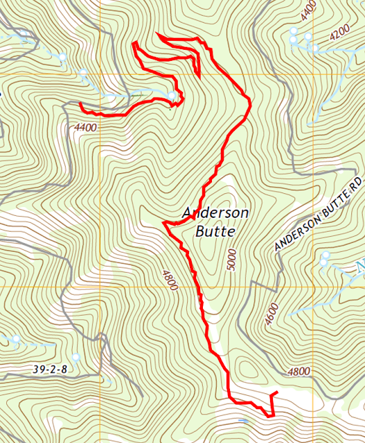
This Upper segment was part of Phase I of the Jack Ash trail and opened in 2017. Phase 2 will connect to the Jacksonville, Ashland, and Applegate Ridge Trail systems. Here are our statistics for this hike which can also be accessed by Anderson Butte Road:

Distance: 3.4 miles
Duration: 1 hours, 22 minutes
Minimum Elevation: 4269 feet
Maximum Elevation: 5019 feet
Other trail users seen: 0


9/25/2021

Squaw Lakes Quadrangle Hikes

Little Grayback Trail # 921 

This trailhead is about a 40 minute drive from Jacksonville and is accessed by Forest Service Road 490. There is a short drive from the Forest Service Road to the trailhead. More details on the 5.4-mile hike (10.8 total miles) are available from the U.S. Forest Service and other websites below. It's an out-and-back hike with an elevation gain of 1,800 feet. 

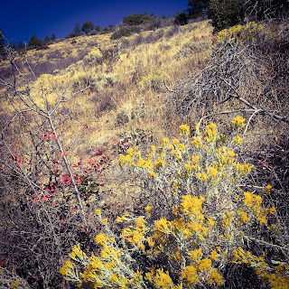
The trail is lightly used, although it appears to be open to OHVs. It winds through a wide range of land forms, including closed forest and glades. It's a nice late season hike due to the sun exposure. We noticed some buggy conditions in the lower part of the trail and several late season butterflies including fritillaries, satyrs, skippers in the open areas. There is no water on the trail. Additional links to this hike:


Da-Ku-Be-Te-De Trail # 940 

We only hiked a small part of this trail in early October. The full trail is 4.8 miles and ends at Watkins Campground. The area looks as though it would be crowded during peak months and higher water. The Applegate Lake was only 19% full, which made for very steep slopes along the trail's edge. There are beautiful views of the lake, but the hike is flat and it probably gets heavy use in the peak months.  Additional links to this hike:

Charlie Buck/Baldy Peak Trail #918

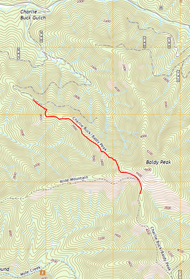
This trail is a steep one, so be prepared and take plenty of water. It would be quite hot in the summer as there are a lot of exposed areas, but it was perfect in mid November. The views are amazing and the steep climb keeps the traffic down. According to the McKee Bridge Historical Society, Charlie Buck was one of seven children of William and Matilda Buck, who came to the Little Applegate from California in 1874. The Charlie Buck Trail is located on Baldy Peak where the family grazed cattle. Additional links to this hike:


Here are the statistics for our hike, which I measured only on the descent:

Distance: 1.6 miles
Duration: 35 minutes
Minimum Elevation: 3088 feet
Maximum Elevation: 4339 feet
Other trail users seen: 0


3/24/2020

Lower Table Rock - A Southern Oregon Hiking Treasure

Upper and Lower Table Rock are very special natural resources in Southern Oregon. It is possible to hike up both for spectacular views of Sams Valley and Mount McLoughlin. They are also sensitive habitat due to the presence of vernal pools, which are seasonal wetlands that provide habitat for distinctive plants and animals found nowhere else. These species have adapted to the unusual "flood and drought" habitat conditions of vernal pools. Most of the historical vernal pool habitat has been destroyed. According to the Oregon Fish and Wildlife only 23 percent of Oregon's original vernal pool habitat in the Agate Desert remains intact. Being a designated area of critical environmental concern, it's important to remember to stay on the trails when visiting.

The hike to the summit of Lower Table Rock winds through mixed oak woodland and Oregon white oak savanna and chaparral ecosystems. Heavily grazed for an extended period, efforts are underway to restore these areas to the characteristic open habitat of the fire-adapted ecosystem. The trail begins off Wheeler Road. From Central Point, head east on East Pine Street about one mile and turn north (left) on Table Rock Road. Drive eight miles to Wheeler Road and turn west (left). The trailhead is about 0.5 miles on the left. There is no parking fee.  


The hike is 3.5 miles round trip gaining about 780 feet in elevation. The difficulty class is Class 1, Easy. Most of Lower Table Rock was dedicated as a nature preserve in 1979 by The Nature Conservancy.  Both the Upper and Lower Table Rock buttes are horseshoe shaped. According to the Bureau of Land Management,

About 7.5 million years ago, a shield volcano erupted near Lost Creek Lake and spread lava over the entire valley. This mass of lava caused the valley floor to rise in elevation to the height of the Table Rocks. Over millions of years, the ancient Rogue River meandered through the valley, eroding and carving away approximately 90 percent of the lava rock. What remains are a few solitary large rock masses, or monoliths, and two horseshoe-shaped mesas known as the Table Rocks.

Shield volcanoes are a type of volcano usually composed almost entirely of fluid lava flows. The lava has low viscosity which means it flows easily and forms low angle slopes.


An old airstrip is visible on the summit, which was closed in 1980. John Day, a local rancher, built the airstrip in 1948 to impress visiting celebrities from Hollywood. He intended to sell residential lots to celebrities who would use the runway.

Airstrip

This area of Southern Oregon is the traditional homelands of the Takelma tribe. The land between Upper Table Rock and Evans Creek was a temporary Indian Reservation between 1853 and 1856. The Table Rock Reservation was created by treaty in 1853 when Rogue River tribes ceded millions of acres of land to the United States in exchange for peace, safety, and a permanent reservation. Before a permanent reservation could be established, the Native Americans remained at Table Rock. However, they became a target of continued acts of genocide by settlers in the region. Because of this, they fought a series of battles and were forced onto the Grande Ronde in the western Willamette Valley. The peaceful tribes who remained on the Table Rock Reservation were marched over 300 miles to the new reservation between February and March 1856.

This is one of the most popular hikes in the Medford area with an estimated 50,000 visitors per year. Guided hikes are available through the BLM's Table Rock Environmental Education Program which posts a schedule. Hikes are on weekends in April and May and are free to the public with reservations required. Schedules are posted in March.

View of Upper Table Rock and Mount McLoughlin

2/24/2020

Kenneth Denman Wildlife Area: A Southern Oregon birding gem

This 1,858-acre wildlife area is located about five miles north of Medford in Jackson County, southern Oregon. The area is bordered by the Rogue River and offers an impressive variety of habitats for birds including oak woodlands, grasslands, ceanothus shrublands, riparian habitat, and intact vernal pools, which are all considered to be at-risk habitat. The area is located within the  former Camp White U.S. Army Cantonment, which was deactivated in 1946 after the end of World War II. In 1954, the area was conveyed to the Oregon Game Commission and the wildlife area was established. Several ammunition bunkers are still in place.


While the major function of the wildlife area’s management is to provide waterfowl, upland bird
and deer hunting opportunities, it is also a very accessible area to consider if you are looking to do some bird watching in southern Oregon not far off the beaten path. Be aware that a $10 parking permit is required. There is an 0.7-mile interpretive trail in the southwestern region of the Little Butte Creek Unit of the wildlife area with many opportunities for bird watching. The interpretive trail is on the south side of Touvelle Road. Another trail on the north side of the road will lead you to the former Camp White ammunition bunkers.

Map showing approximate bunker locations. Original USFWS map can be found here
We visited the area in late February, which is a bit early for migrating birds. Based on our anecdotal observations, the Acorn woodpeckers and common merganser ducks were most abundant during our visit. I was able to find a bird species list for nearby Agate Lake, which is another popular birding spot 11 miles east of the Denman Wildlife Area.

Checklist of Birds found at Agate Lake (Adapted by Otis D. Swisher from Janes et al., 1996) 
(R) Year long resident; (S) Summer visitor; (W) Winter; (P) Passing through on migration; co =  Most likely seen on coast; la = Most likely seen in lake basins of Klamath and Lake Counties; mo = Most likely seen in mountains

Panoramic view of Table Rock and wetlands
There was plenty of evidence in dead snags that the acorn woodpeckers (Melanerpes formicivorus) use the area heavily.


This wildlife management area contains the largest known area of vernal pool areas in the Rogue Valley (ODFW Vernal Pool Fairy Shrimp Survey 1999). I really wish that the interpretive trail and vernal pools were better marked with more detailed information on their importance and the conservation status of associated species. According to EPA, the unique environment of vernal pools provides habitat for numerous rare plants and animals that need them to survive. Many plants and animals spend the dry season as seeds, eggs, or cysts, and then grow and reproduce when the ponds are again filled with water. In addition, birds such as egrets, ducks, and hawks use vernal pools as a seasonal source of food and water. A 2007 paper from the Agate Desert Technical Advisory Committee describes the importance. The vernal pool ecosystem is valued for its role in supporting biological diversity of unique plant and animal assemblages, including federally listed species.

The Hall Tract is another part of the wildlife area to the south of Antelope Road. Most of the irrigated farm land found on the wildlife area is located on this tract. The land is flood irrigated through a system of reservoirs and ditches. Public areas consists mainly of a large fishing pond. To my knowledge, there are no access trails for bird watching.

We will definitely return to this site during the peak migration and update this post on the outcome.

12/27/2019

Fruit Lands and Turkey Town: Exploring Sutherlin and Oakland, Oregon

We've driven past the Sutherlin exit on Interstate 5 many times. Usually, we make a regular stop to eat at Romulos Mexican Grill (highly recommended!), but a brief look into the history of the area made me want to explore more and drive further in see to historic downtown Sutherlin.  


Sutherlin, once known as "Camas Swale," was organized into a town site from a large ranch inherited by Anne Sutherlin Waite from her pioneer father, Fendel Sutherlin (1824-1901). Anne and her husband, Frank Waite, decided to sell off the land as small farms. The camas wetlands throughout the area, drained by Fendel Sutherlin, were laid out into orchard tracts (mostly apples) between five and twenty acres in size by the Luse Land and Development Company (Frank Waite and J.F. Luse). The idea was to sell the tracts to home seekers in the mid-western and northeastern states with a contract requiring homeowners to maintain the orchards for several years. A post office was established, and the town was incorporated in 1911. Frank Waite built a small hotel, and a train depot site was donated to the Southern Pacific Railroad. Streets were laid out, a business district was built, homes were erected and the population was reported to be 800 by 1915 (The News-Review, Roseburg, Oregon, March 10, 1915).


Pioneer Life of Fendel Sutherlin by Anne Sutherlin Waite, Oregon Historical Quarterly
Vol. 31, No. 4 (Dec., 1930)
Many of the buyers, believing their property would produce a profit within five years, sold after the orchards were not yet at a level of production to make money. Other property owners were found to have torn out the orchards for more profitable crops or animals. Some, however, retained their properties and were rewarded with a fruit industry that grew to a level requiring the construction of two large packing plants and a fruit spray manufacturing plant. A box factory was constructed to supply fruit boxes for the growers, and the Sutherlin Lumber Company was formed. The town became known as the "Orchard Center of Douglas County." However, the financial return on the produce was low due to the high costs of shipping the fruit to major markets in the east. The last packing plant shut down in 1928 as the Great Depression began.

Sutherlin, Oregon in 1911 from "Sutherlin" by Tricia Dias
The Coos Bay Times (Marshfield, Oregon) · 1 Feb 1916
Above the valley, immense stands of timber were controlled by the Roach Timber Company. The owner, William Leroy Roach, made arrangements to construct a railroad line through the valley and up to the timber and logging camps. This enabled the transfer of timber from the logging camps into Sutherlin, where it was then transferred to the Southern Pacific Railroad's main railroad line. There were plans to build a large sawmill in Sutherlin; however, in August 1916 William Roach passed away from pneumonia, and the mill never materialized. The railroad line closed in 1961 after Weyerhaeuser purchased a mill to the north near Cottage Grove. The new mill purchase included a truck road, and it was decided that operations would be moved to the holdings northeast of Springfield.

       William Roach (Lumber World Review - July 10, 1916)

Weyerhaeuser #100

The town experienced a lumber boom in the 1940s. Other sawmills were constructed in Sutherlin, several of which were located at the present location of Murphy Plywood on Central Avenue. A few of the more long-term mills in operation include the L&H Lumber Company (1946-74); Springfield Plywood Corporation (1942-64); Nordic Plywood Corporation (1954-75); Mt Mazama Plywood Company (1975-85); and Murphy Plywood Company (Larry Moulton 2002).

The timber industry declined in Oregon during the 1980s from depletion of forest resources and new environmental restrictions creating the worst recession the state had experienced.  It was no exception in Sutherlin. The Mt. Mazama Plywood Company filed for bankruptcy in the mid-1980s ending employment for 185 workers. Murphy Plywood opened following the Mt. Mazama closure, but was  forced to shut down twice within one year due to poor market conditions. Unlike the more well-known destination, Bend, Oregon which capitalized on its scenic beauty and was successful in attracting companies in the aviation industry, Sutherlin was, unfortunately, not able to rebound from the lumber industry downturn.

Corvallis Gazette-Times - 25 Sep 1984

Today, Sutherlin remains an economically depressed town. I have to be frank - in my view, there is really no reason to visit at the present time.  There is no trace of the former orchard tracts, which have since been razed and devoured by rusting single-wide trailers and "canned ham" campers with a backdrop of heavily timbered hillsides. The downtown area is dilapidated with boarded windows and dingy storefronts. The one tourist feature of the town is the Weyerhaeuser #100 locomotive, retired in 1958, used to haul logs on the Roach Timber Company's railroad line. There is a plaque in front that says nothing about the train or the town's history. It is my personal opinion that Douglas County's economic revitalization lies, in large part, on its history, preservation of its forests, and restoration of its once glorious camas wetlands. One of the oldest stands of old growth timber in the world is found in Douglas County.

Downtown 1927
D.W. Banker Building (1916) and Sutherlin Bank Building (1910) on the corner of Central and State Streets. Then bank closed in 1933 due to poor economic conditions and reopened 1949-1973

A somewhat more interesting and well maintained historic town lies just five minutes north of Sutherlin. The town of Oakland, Oregon was founded by Dr. Dorsey S. Baker who constructed one of the state's first flour mills (1851). The mill wheel from Baker's grist mill is on display at the city park at the northeast corner of Second and Maple Streets.


Oakland was also a former stage coach stop on the route from California to Portland. The original town site during the stage coach years was actually one mile north of the present location. The town was moved to its present location in 1872 when the townspeople learned that the new railroad line would bypass Oakland. Some of the buildings were dismantled and rebuilt at the present location. The official stop for the stage coach was at the Pacific Hotel owned by Jonathan Tibbetts. Unfortunately, this hotel was not relocated and no longer exists. Other early establishments relocated from the original town site include the Deardorff Hotel (1860) at 337 NE First Street, the James Dearling House (1855) at 207 SE Second Street (originally a saloon in the old townsite), and James Dearling Cobbler Shop (pre-1871) at 226 Locust Street. Several additional residences were also relocated some of which include:


237 SE Second Street (c. late 1860s):


236 SE Second Street (c. 1865):


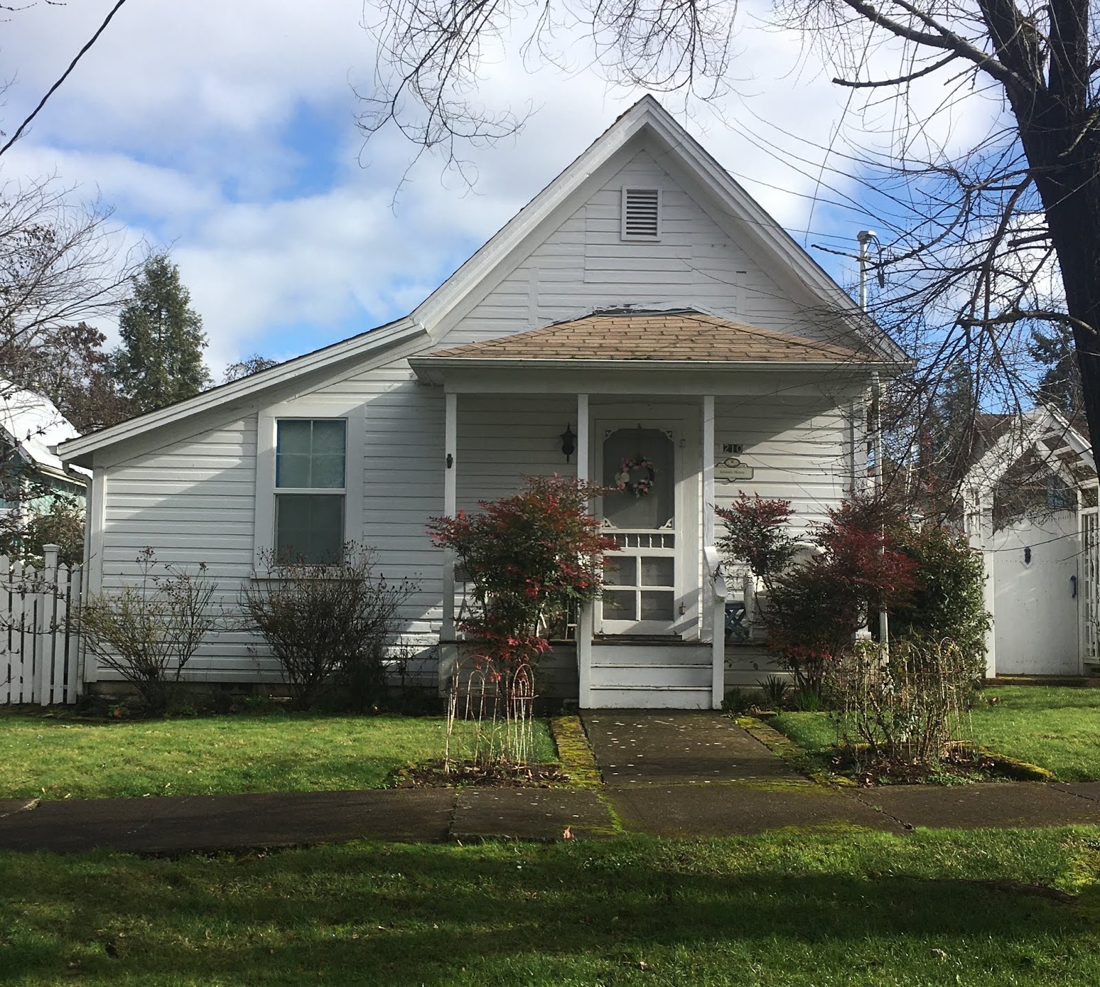
210 SE Second Street (pre-1871):


333 NE First Street (1850s):


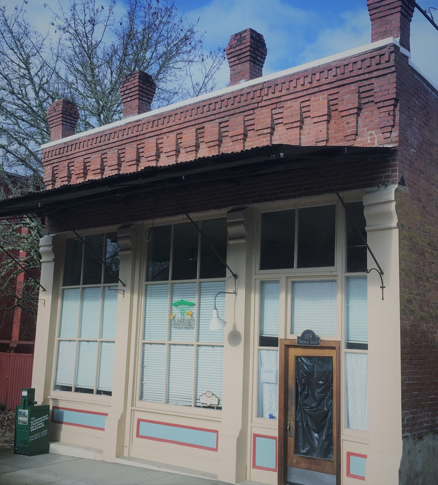
After the relocation of the town to its present site, Oakland became an important railroad shipping point for the surrounding area. The railroad stimulated construction, although two fires in the mid-1870s and 1890s destroyed many of the original wooden structures. Many burned establishments, such as the Depot Hotel (1899) at 101 Locust Street, and J.H. Mahoney saloon building (1899) at 109 Locust Street, were replaced with brick buildings.

Thomas Hotel building (1899), originally the Depot Hotel

Harvey J Mahoney building (1899), a former saloon


Both buildings can be seen on Locust Street on the 1889 Sanborn Fire Insurance Map.


By 1922 the population of Oakland grew to about 700. The town became known as the center of the turkey industry for the north Pacific Coast. In addition to turkeys, Oakland was known for its stock raising industry including sheep, hogs and cattle. Unlike Sutherlin, the consistent farming industry allowed Oakland to weather economic fluctuations. By 1929, Oakland ranked sixth in the nation in turkey production, although breeding began to decline in the mid-1940s.


The News-Review - Roseburg, Oregon 27 Feb 1961
During WWII, Oakland also benefited from the lumber boom. The city expanded to twice its original size. Oakland's chief contribution to the lumber boom was through its being the headquarters site in Douglas County for the Martin Bros. Box Company which opened in 1946. It manufactured wirebound shipping containers, lumber and plywood. 

Another industry stimulating growth included quicksilver mining. The original deposits were discovered in 1870 and abandoned after small production; however, the Bonanza mine was reopened in 1937 by H.C. Wilmot who organized Bonanza Mines, Inc. After reopening, production was low until the main (north) ore body was discovered in 1939. By 1940, the mine led all mercury producing mines in the United States. Some of the ore ran as high as 120 pounds of mercury to the ton, but it averaged only 7 or 8 pounds (USGS 1947, Quicksilver Deposits of the Bonanza-Nonpareil District, Douglas County, Oregon Bulletin 955-F). The mine was located about six miles east of Sutherlin and operated until 1961 with other closures prior to that time. Total recorded mercury production was 39,540 flasks (or 3,005,040 pounds).

Environmental investigations completed in the late 1990s show that soil and sediment at the former mine are contaminated by mercury, arsenic, and other metals. Cleanup of the site began in 2014.