Whitewater Rafting on the Yampa River - Deerlodge Park to Split Mountain
With no major dams and diversions, the Yampa River is considered one of the last wild rivers in the West. It is the longest free-flowing tributary in the Colorado River basin and the largest tributary to the Green River. Its headwaters begin in the White River National Forest of northeastern Garfield County, Colorado. It is joined by the Little Snake River before entering Dinosaur National Monument and ultimately joins the Green River in Echo Park in extreme northwestern Colorado.The trip began at Deerlodge Park. From this point, we floated on the Yampa for 46 miles to Echo Park where it joins the Green River. The notable rapids included Teepee Rapid (III), Big Joe Rapid (III) and Warm Springs Rapid (IV).

The Yampa meanders through the Yampa Canyon, with spectacular tilted beds of sandstone. Smooth canyon walls overhang the river in some places towering up to 1,000 feet above the water. We had some rainy weather the first day with a 20 mile float to the first campsite, Big Joe. The weather cleared the next morning giving us the opportunity to explore the area. There were some beautiful rock formations near this campsite a short distance up a small gorge.
 |
| Big Joe Campsite |
 |
| Rock Formations near Big Joe Campsite |
The name Yampa is derived from the Snake Indians word for the Perideridia plant -- a tall, grass-like plant in the Parsley family. Yampah was a major food plant of the Native Americans, who would collect its root, dry it, and pound it into a white meal. John C. Frémont recorded the name 'Yampah' in entries of his journal from 1843 (Report of the exploring expedition to the Rocky Mountains in the year 1842 : and to Oregon and north California in the years 1843-44 by Frémont, John Charles, 1813-1890; Torrey, John, 1796-1873; Hall, James, 1811-1898; United States Army Corps of Engineers, Published 1845):
"It grows more abundantly, and in greater luxuriance, on one of the neighboring tributaries of the Colorado than in any other part of this region; and on that stream, to which the Snakes are accustomed to resort every year to procure a supply of their favorite plant, they have bestowed the name of Yampah river."The second day was a bit rainy again, but short. We stopped to check out a cave known as Signature Cave. There was a lot of graffiti inside the cave made by river runners from the 1930s and 1940s.
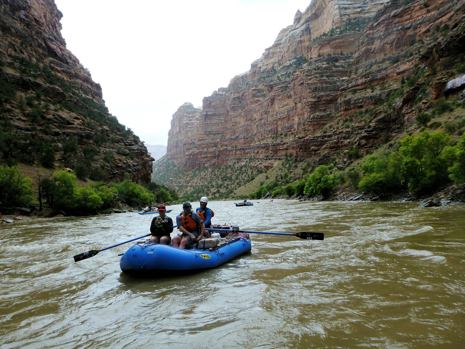 |
| Traveling between Big Joe and Mathers Hole Campsites |
 |
| View from inside Signature Cave |
Mathers Hole campsite was beneath a large overhung cliff that is about 500 feet tall. The area beneath the overhang was sheltered from rain and very sandy -- perfect for horseshoes.
 |
| A game of horseshoes beneath Mathers Hole overhang |
There were additional opportunities for hiking at Mathers Hole. One of the trails led to the top of the canyon for an incredible view of the river below.
 |
| View of Yampa River near Mathers Hole campsite |
We spotted several types of birds and signs of beavers. The Yampa River is important spawning habitat for the endangered Razorback sucker (Xyrauchen texanus) and Colorado pikeminnow (Ptychocheilus lucius), the largest minnow in North America, which historically reached lengths of 6 feet. Today they typcially reach lengths of 2-3 feet. Other endangered species in the Yampa River include humpback chub (Gila cypha) and bonytail (Gila elegans) Eighteen non-native fish species have been introduced some of which include channel catfish, common carp, green sunfish, northern pike, red shiner.
The weather cleared on day three from Mathers Hole campsite to Laddie Park campsite. While it was another short day, the scenery was amazing. Photographs do not come close to capturing the spectacular canyon walls, such as the Grand Overhang and Tiger Wall (actually on day 4 between Laddie Park and Sea Cliff Beach campsites).
 |
| Grand Overhang |
 |
| Tiger Wall |
En route to Sea Cliff Beach campsite, we arrived at Warm Springs Rapid, the only class IV on this trip. Apparently the rapid was created in 1965 by a flash flood that washed a debris flow down Warm springs Draw. There is a 1,500 foot cliff here, the tallest on the trip, but most folks were focused on the rapid. The main hazard here is Maytag Hole which can flip boats. Not being a fan of class IVs, I was the only person who chose to walk, but all bodies and boats made it through with no trouble.
A film was released by Friends of the Yampa in November 2014 about the Yampa River and formation of the Warm Springs Rapid. Check it out ONLINE.
Shortly before reaching Sea Cliff Beach, we reached the confluence of the Yampa and Green Rivers.
 |
| Confluence of the Yampa and Green Rivers |
 |
| Christi enjoying the scenery with "Wilson" |
The next day, we traveled between Sea Cliff Beach campsite and Jones Hole campsite. Near Jones Hole Creek, there were several trails to hike, one of which led to some 1,000 year-old pictographs created by the Fremont people.
 |
| Pictographs by the Fremont People |
 |
| Checking out the pictographs |
There was also a waterfall, which we all found to be entertaining (and refreshing after camping for several days)... and bunnies too!
 |
| Karen's turn! |
 |
| A bunny on the trail |
Our last night of camping was at Island Park, near "Bug Island".... eh em... I mean Big Island. There were soooo many mosquitos! Everyone dealt with it in good spirits.
Overall it was an amazing trip and a wonderful group. I didn't take many photos on the water, but I'll end with a small clip taken towards the end of the trip. The flow during the trip was between 7,500 and 8,000 cfs, which seemed just great. Because its natural flooding process is essentially undisturbed, this is definitely a precious natural resource to be protected. I feel so lucky to have had the opportunity to have this experience.


